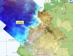
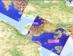
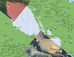
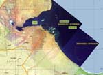
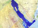
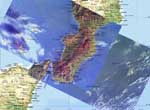
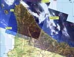
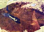
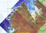
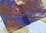
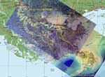
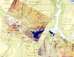
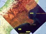
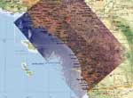
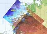
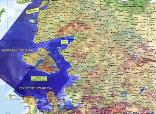
ISS EarthKAM header EarthKAM Logo NASA logo US Space and Rocket Center Logo UAH Logo Teledyne Brown Logo
 

Composite Images

There are thousands of images available within the ISS EarthKAM Datasystem, and throughout each mission, there are sometimes sets of two or three images that provide an extended view of a particular region. Here they have been superimposed onto maps produced by Microsoft Encarta Atlas 2002 so that it is possible not only to get a more complete view of the area all at once, but also to see exactly where cities and other major landmarks are in the image. Some locations have been highlighted on the images to enhance the readability of the text.

Anson Bay, Northern Territory, Australia

Anson Bay, Northern Territory, Australia
Athens, Greece

Athens, Greece
Cambodia

Cambodia
Djibouti, Africa

Djibouti, Africa
Gulf of Suez, Egypt, and Saudi Arabia

Gulf of Suez, Egypt, and Saudi Arabia
Italy

Italy
Hokkaido, Japan

Hokkaido, Japan
Kazakhstan

Kazakhstan
King Sound, Western Australia, Australia

King Sound, Western Australia, Australia
Lake Huron, USA, Canada

Lake Huron, USA, Canada
Mississippi River Delta, Louisiana, USA

Mississippi River Delta, Louisiana, USA
Las Vegas, Nevada, USA

Las Vegas, Nevada, USA
Banks Penninsula, New Zealand

Banks Penninsula, New Zealand
Los Angeles and San Diego, USA

Los Angeles and San Diego, USA
St. George Basin, Western Australia, Australia

St. George Basin, Western Australia, Australia
Aegean Sea, Turkey

Aegean Sea, Turkey
  

Other Image Collections