Favorite Image: STS099.ESC.00235549
Cape Cod, Massachusetts
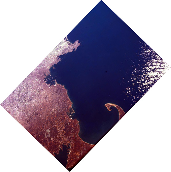
The distinctive shape of Cape Cod, Massachusetts, and the greater Boston urban area are very clear in this image of the northeastern coast of the United States. Urban areas often appear light gray and detailed from space. Knowing that, can you tell how extensive the Boston area is? Notice all of the islands in Boston Harbor. Thirty of them constitute the Boston Harbor Islands National Recreation Area. The islands were formed when the sea at the end of the last Ice Age inundated the glacier-carved landscape. The squared-off barrier island across from the tip of Cape Cod outlines Plymouth Bay. Plymouth is the site where a group of intrepid pilgrims seeking freedom from religious persecution in England landed in 1620. The annual Thanksgiving Day holiday observed in the United States celebrates the feast of their first harvest.